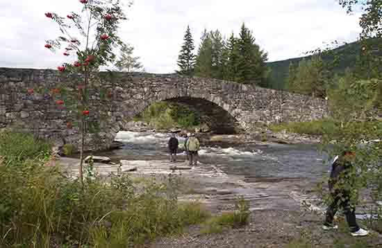
The Lunde Bridge is about 5 km from the campsite, direction Bruflat. It is the largest bridge of Northern Europe that is made of stone. The bridge was built from 1827 to 1829 as part of the royal road between Oslo and Bergen.
In the 2nd World War the Norwegian troops tried to blow up the bridge so to stop the German troops. They were not successful (fortunately), otherwise we had not such a beautiful bridge.
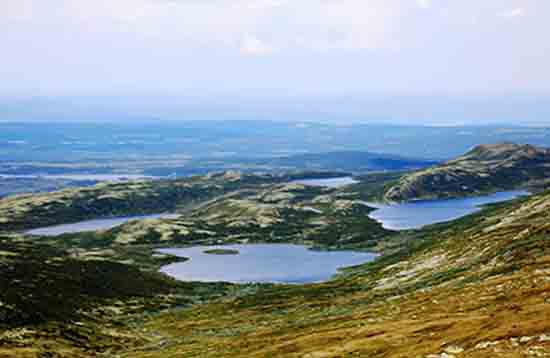
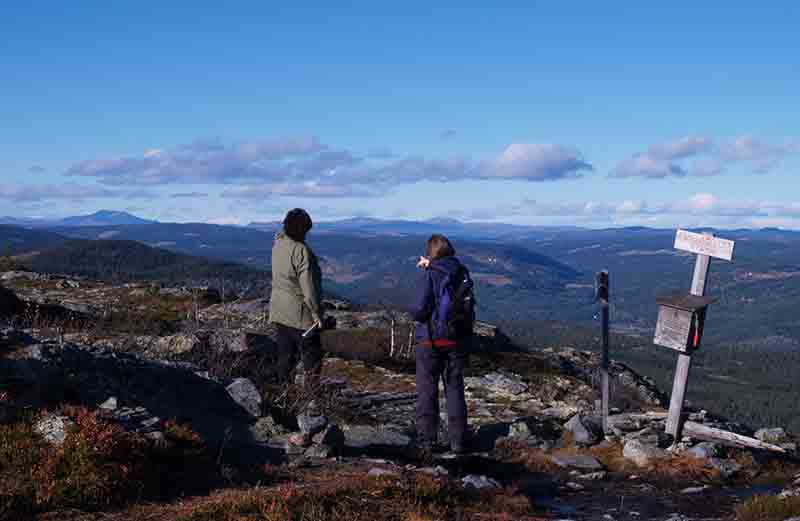
In the north of Etnedal is Synnfjell. It is a beautiful nature where you can walk, mountain biking, riding and canoeing in summertime.
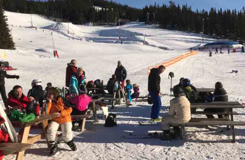
In winter there are many “loipes” for cross-country skiing and there is a small descent for children.
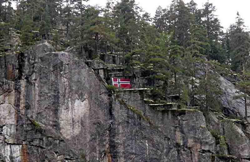
Against the mountain of Madslangrud, along the road Rv 33, is painted the oldest mountain flag of the Valdres. It was painted because of a double wedding in Oystuen in Sør-Etnedal. The idea came from an English lady.
Langsua National Park is a national park that is located in a forest and low mountains north of Lenningen. The park was established on March 11, 2011 and has an area of 537.1 km².
The area is of international importance for Bearded Bellflower and rare plant Viking Sedge. The park is also home to birds such as the Hen harrier, the Broad-billed sandpiper and Common snipe. All predators visit the area, but only the lynx has his habitual residence here.
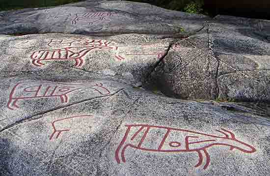
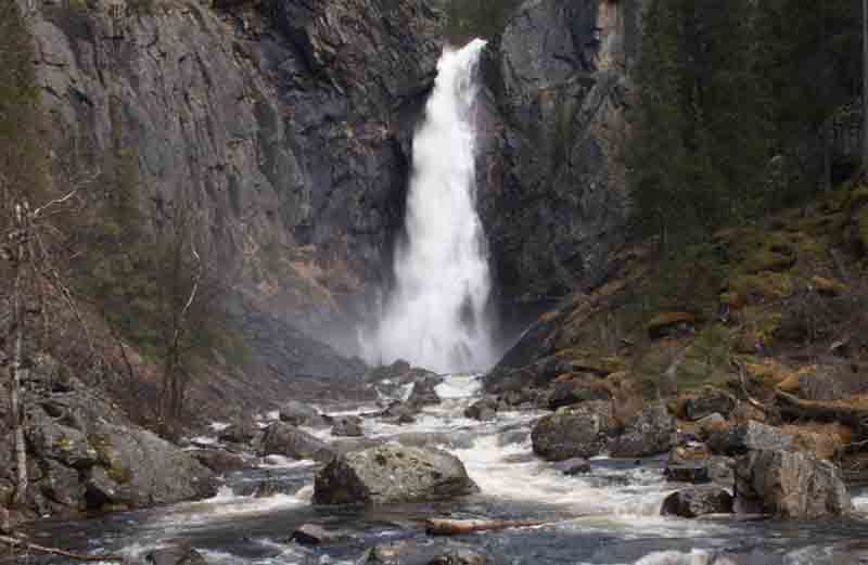
The rock drawings in Møllerstufossen are some petroglyphs of mainly elk. It is situated near the waterfall Møllerstufossen in the Norwegian municipality of Nordre Land. The age of the drawings is estimated to be about 6000 years. The biggest rock drawings measures approximately 90 centimeters and the whole is approximately 20 square meters in size.
The drawings are recolored and a wooden bridge makes the site accessible.
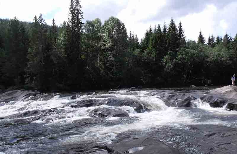
Etna rises in Øystre Slidre and runs through North Aurdal throughout the municipality Etnedal, from north to south.
In the valley along the river one finds the most activity. The river is known for its good fishing and kayaking, especially in spring when the water is at its highest.
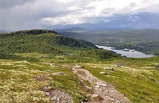
For a kid-friendly hike with great views of Etnedal. Also suitable for the smallest - from 2-3 years. The walk takes only 30 minutes and the height is 30 meters.
The nearest place you can cross-country skiing and snowboarding is Alpine Aurdal and located in Nord-Aurdal, about 25 km from Etna Family Camping.
It is the largest waterfall in Etnedal. The waterfall is hidden among tall trees, north of Rust.